Papua New Guinea Earthquake: Latest Updates on the October 7 Event
2025年10月08日
This article details the October 7 Papua New Guinea earthquake, covering its magnitude, epicenter, immediate impact, and ongoing response. Understand the region’s seismic activity and the challenges of recovery.
目次
Overview of the Papua New Guinea Earthquake on October 7
Initial Reports and Magnitude Details
Key details of the initial reports are summarized below:
| Detail | Information |
|---|---|
| Date | October 7, 2025 |
| Time (UTC) | 11:05 AM |
| Time (Local PNG) | 9:05 PM |
| Initial Magnitude | 6.7 (USGS, GFZ) |
| Revised Magnitude | 6.6 (USGS) |
| Reporting Agencies | United States Geological Survey (USGS), German Research Centre for Geosciences (GFZ), European-Mediterranean Seismological Centre (EMSC) |
Epicenter and Depth of the Earthquake
Detailed information regarding the earthquake’s epicenter and depth is provided below:
| Characteristic | Measurement/Location |
|---|---|
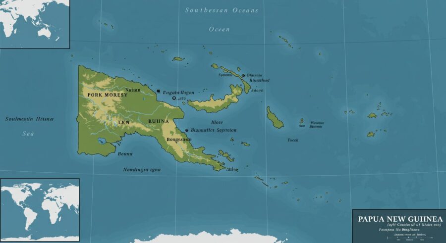
| Epicenter Location | Approximately 26 km (16 miles) west-southwest of Lae, Morobe Province, Papua New Guinea |
| Proximity to Major Cities | 21.8 km (13.6 miles) west of Lae; 309 km (192 miles) from Port Moresby |
| Depth | 99-99.4 km (61-62 miles) |
| Initial Coordinates | 6.70 degrees south latitude, 146.80 degrees east longitude |
Immediate Impact and Consequences in Papua New Guinea
Damage Assessment and Infrastructure Disruption
The magnitude 6.6 earthquake that struck near Lae, Papua New Guinea, on October 7, 2025, generated significant ground shaking across the affected region. Local officials, including Lae police official Mildred Ongige, described the tremor as “very huge” and expressed immediate concerns, although initial reports did not confirm widespread significant damage or casualties.
Witnesses in Lae, such as government official Malum Nalu, characterized the earthquake as “very violent,” recounting a “big rumbling noise” and intense shaking of buildings for approximately three minutes during a public gathering. While this event caused panic and a rush for exits, the crowd reportedly dispersed safely. Despite the strong tremors, widespread destruction was not immediately reported. However, visual evidence from Lae indicated cracks appearing on building walls.
The United States Geological Survey (USGS) issued a Green alert for shaking-related fatalities and economic losses, suggesting a low likelihood of casualties and damage. This assessment considers the region’s building stock, which includes a mix of vulnerable constructions like informal structures (metal, timber, galvanized iron) and unreinforced brick masonry, alongside more earthquake-resistant designs.
The earthquake’s intermediate depth, approximately 99 kilometers (61 miles), typically helps to mitigate surface damage compared to shallower earthquakes of similar magnitude. Nonetheless, the Pacific Disaster Center (PDC) highlighted potential vulnerabilities in Lae, a crucial port city, noting risks to vital infrastructure such as power grids and roads, challenges exacerbated by Papua New Guinea’s rugged terrain and limited emergency resources. Local authorities in Lae have commenced building inspections to evaluate structural integrity.
Secondary hazards are also a significant concern. Liquefaction, where saturated soil loses strength during shaking, is estimated to be significant in severity and/or spatial extent. While extensive landslides are not widely anticipated, localized landslides remain a possibility in highly susceptible, steep areas, potentially causing isolated damage or fatalities.
Estimated Population Exposure to Shaking Intensity
| Shaking Intensity (USGS PAGER) | Estimated Population Affected |
|---|---|
| Strong | Approximately 21,000 people |
| Moderate | Approximately 503,000 people |
| Light | Approximately 1,844,000 people |
| Weak | Approximately 150,000 people |
Casualties and Injuries from the October 7 Earthquake
In the immediate aftermath of the October 7, 2025, earthquake, there were no confirmed reports of deaths or injuries. The USGS assessment indicated a low likelihood of casualties. While local officials expressed concern, they had not received details of any injuries at the time of initial reports.
Tsunami Watch and Official Warnings
Crucially, no tsunami warnings were issued by the Pacific Tsunami Warning Center (PTWC) or other relevant authorities following the October 7 earthquake in Papua New Guinea. The quake’s intermediate depth of around 99 kilometers (61 miles) and its inland epicenter near Lae significantly reduced the risk of generating a destructive tsunami. Statements from agencies like Tsunami.gov explicitly confirmed that there was no tsunami threat to surrounding regions, including Guam, Rota, Tinian, or Saipan.
Response and Relief Efforts
Initial Situation and Damage Assessment
As of October 7, 2025, immediate reports indicate that there are no significant casualties or widespread damage following the magnitude 6.6 earthquake that struck near Lae, Papua New Guinea. The United States Geological Survey (USGS) issued a Green alert for shaking-related fatalities and economic losses, suggesting a low likelihood of substantial impact.
Despite the strong tremor, which was felt by approximately 2.5 million people across Papua New Guinea, including those in areas experiencing strong shaking, initial assessments are ongoing. Authorities are currently evaluating the situation in affected areas, particularly around the epicenter located west-southwest of Lae in Morobe Province, to confirm the extent of any potential localized damage to infrastructure or communities.
Local Government Emergency Protocols
Papua New Guinea has established protocols for disaster response, typically coordinated by the National Disaster Centre (NDC) in conjunction with provincial disaster committees. While no specific activation details for this earthquake have been widely reported yet, the standard procedure involves rapid assessment and the potential deployment of emergency services. These services include the Royal Papua New Guinea Constabulary, health officials, and elements of the Papua New Guinea Defence Force, which stand ready to provide security, medical assistance, and logistical support if needed.
The primary focus of local government actions in the immediate aftermath of such an event is to ascertain the safety of residents and the integrity of critical infrastructure. This involves:
| Entity | Key Role in Disaster Response |
|---|---|
| National Disaster Centre (NDC) | Coordinates national-level disaster preparedness, response, and recovery efforts, acting as the central hub for information and resource allocation. |
| Provincial Disaster Committees | Responsible for disaster management at the provincial level, including conducting local damage assessments, initiating immediate local responses, and reporting to the NDC. |
| Emergency Services (Police, Health, Military) | Provide essential services such as maintaining public order, delivering urgent medical care, facilitating evacuations, and offering logistical support for relief operations. |
These entities work collaboratively to determine if humanitarian aid, temporary shelter, food, or medical supplies are required for any affected populations.
Potential for International Support
In the event of a significant natural disaster, Papua New Guinea often receives support from the international community. While there are no current calls for international assistance directly related to the October 7, 2025 earthquake, various international partners typically stand ready to offer aid. Countries such as Australia and New Zealand, along with international organizations like the United Nations (UN) and various non-governmental organizations (NGOs), have historically provided crucial support to PNG during times of crisis.
This support can encompass a range of assistance, including financial contributions, humanitarian aid (such as emergency supplies and shelter), technical expertise for damage assessment and reconstruction, and logistical support for delivering aid to remote areas. The coordination of such international assistance would typically be managed through established channels with the Papua New Guinea government, ensuring that aid is effectively targeted to areas of greatest need.
Understanding Papua New Guinea’s Seismic Activity
The Pacific Ring of Fire Connection
Papua New Guinea (PNG) is situated in a highly seismically active region, primarily due to its location on the Pacific Ring of Fire. This horseshoe-shaped belt around the Pacific Ocean is characterized by frequent earthquakes and volcanic eruptions, resulting from the movement and collision of several major tectonic plates.
The country lies at the complex boundary where the Pacific Plate, Australian Plate, and Philippine Sea Plate interact. Specifically, the Australian Plate is actively colliding with and subducting beneath the Pacific Plate. This significant geological process creates immense stress within the Earth’s crust, leading to the formation of deep oceanic trenches, such as the New Guinea Trench, and generating a high frequency of seismic events.
Earthquakes in Papua New Guinea can occur at various depths. Intermediate-depth earthquakes, which have focal depths between 70 and 300 kilometers, are common in the region. These events represent deformation within the subducted tectonic slabs rather than at the shallower interface between the converging plates. This geological setting makes PNG one of the countries with the highest percentage of its population exposed to earthquake hazards.
Historical Earthquakes in the Region
Papua New Guinea experiences a remarkably high rate of seismic activity, with numerous earthquakes occurring annually. Statistically, the country experiences an earthquake of magnitude 7 or greater approximately every two years, and events of magnitude 6 or greater occur roughly every 17 months.
The history of seismic activity in PNG includes many significant and destructive events. Since 1950, over 3,300 fatalities have been directly attributed to earthquakes, and at least 30 earthquakes have triggered tsunamis, causing additional loss of life and extensive damage.
Notable historical earthquakes that have impacted Papua New Guinea include:
| Date | Magnitude | Location/Impact | Notes |
|---|---|---|---|
| May 7, 1919 | 8.2 | West of Kokopo | Strongest earthquake near Papua New Guinea in the past 125 years. |
| November 16, 2000 | 8.0 | New Ireland, Duke of York region | Caused 2 deaths and a tsunami. |
| July 17, 1998 | 7.0 | Aitape | Triggered a devastating tsunami, resulting in over 2,000 deaths. |
| January 22, 2017 | 7.9 | West of Arawa | Strongest recent earthquake of the past 10 years (as of 2025). |
| May 6, 2019 | 7.2 | Eastern Papua New Guinea | Intermediate-depth earthquake at approximately 127 km. |
| March 2024 | 6.7 | East Sepik province | Resulted in three deaths and destruction of over 1,000 homes. |
| October 7, 2025 | 6.6 | Near Lae, Morobe Province | The subject of this article, initially reported as M6.7. |
The frequency of seismic events underscores the constant geological forces at play. In the 365 days leading up to October 7, 2025, Papua New Guinea experienced 402 earthquakes of magnitude 1.5 or greater. More recently, there were 20 earthquakes in the past 30 days and 6 in the past 7 days, highlighting the ongoing seismic activity in the region.
Current Situation and Ongoing Updates
Aftershocks and Seismic Monitoring
Recovery and Reconstruction Challenges
| Challenge Category | Specific Challenges |
|---|---|
| Infrastructure Damage | Destruction of homes, bridges, roads, power transmission lines, and health facilities. |
| Humanitarian Needs | Displacement of thousands, scarcity of safe drinking water due to contaminated sources, and loss of primary food sources (gardens). |
| Geological Hazards | Severe landslides that cover settlements and block access routes. |
| Logistical Difficulties | Challenges in reaching remote affected areas, often requiring volunteer airlifts and private sector support due to limited government resources. |
| Community Resilience | Need for enhanced early-warning systems, community drills, and the construction of earthquake-resistant buildings. |
Conclusion
The Magnitude 6.7 earthquake that struck Papua New Guinea’s eastern New Guinea region on October 7, 2025, at approximately 20:05 Japan Standard Time (JST) highlights the nation’s constant vulnerability to seismic events. Initial reports confirmed the earthquake’s significant magnitude and depth, with its epicenter located in a geologically active zone. Crucially, authorities quickly confirmed that there was no threat of a tsunami following the tremor.
As Papua New Guinea lies within the highly active Pacific Ring of Fire, such seismic occurrences are a regular feature of its geological landscape. The country has a history of powerful earthquakes, including a M7.6 event in 2022 that caused significant casualties and infrastructure damage, and a M6.9 earthquake in March 2024 which resulted in fatalities and widespread destruction of homes. These past events underscore the ongoing need for robust disaster preparedness and resilient infrastructure development across the archipelago.
While assessments of the immediate impact and potential damage from the October 7 earthquake are currently underway, the absence of a tsunami threat is a relief. The government and local authorities are actively engaged in evaluating the situation, and the focus will undoubtedly shift towards supporting affected communities and initiating any necessary recovery efforts. The continuous monitoring of aftershocks and seismic activity remains vital for ensuring public safety and informing future mitigation strategies.
Summary of October 7, 2025 Earthquake Details
| Parameter | Detail |
|---|---|
| Date of Occurrence | October 7, 2025 |
| Time of Occurrence (JST) | Approximately 20:05 JST |
| Magnitude | M6.7 (M6.6 in some reports) |
| Epicenter | Eastern New Guinea region, Papua New Guinea |
| Depth | Approximately 110 km (or 99 km) |
| Tsunami Threat | None |
| Immediate Impact Status | Damage assessment in progress |
The October 7 earthquake serves as a poignant reminder of the persistent geological challenges faced by Papua New Guinea. The ongoing efforts in seismic monitoring, early warning systems, and community-level preparedness are paramount to building a more resilient future for its people against the backdrop of the dynamic Pacific Ring of Fire.